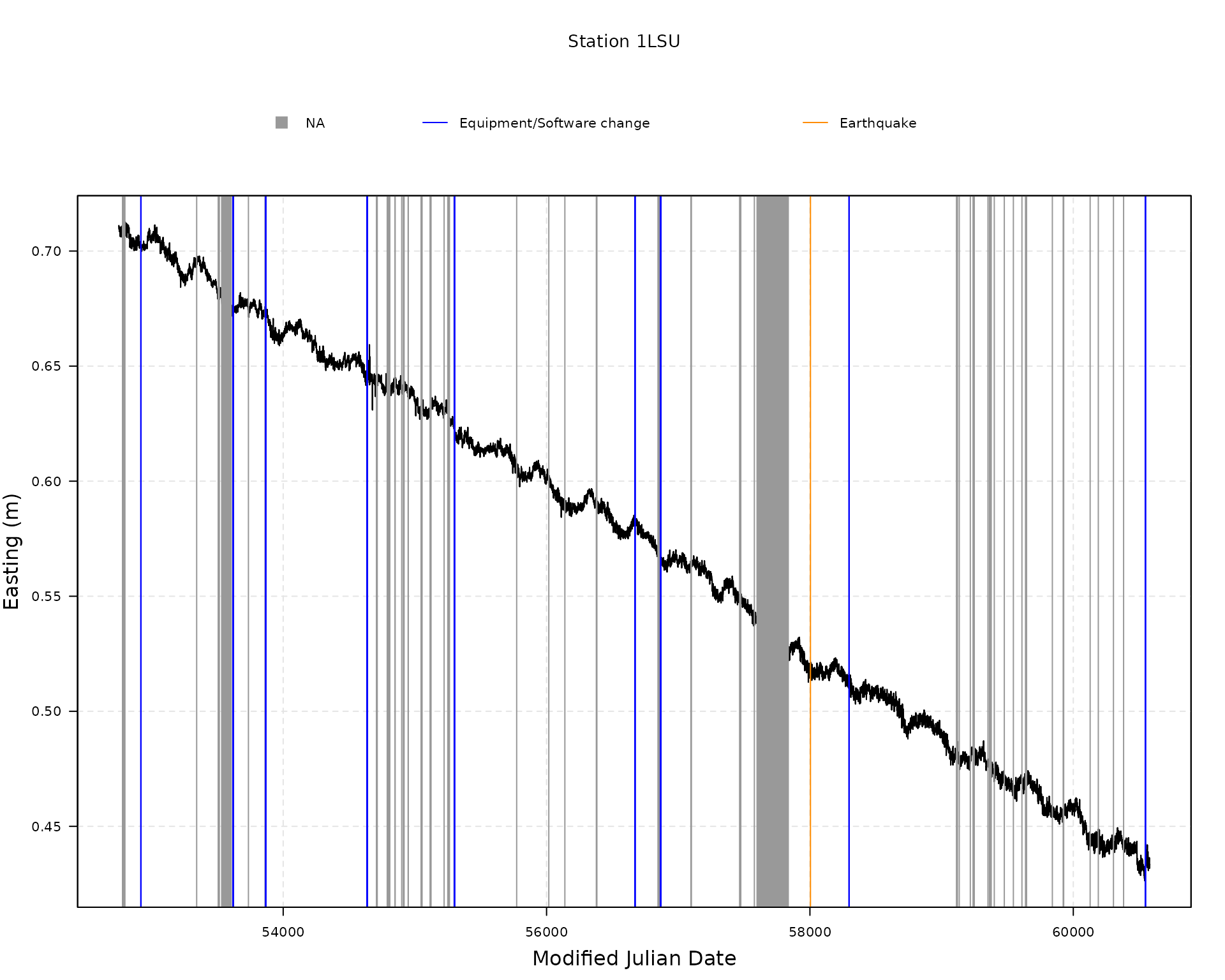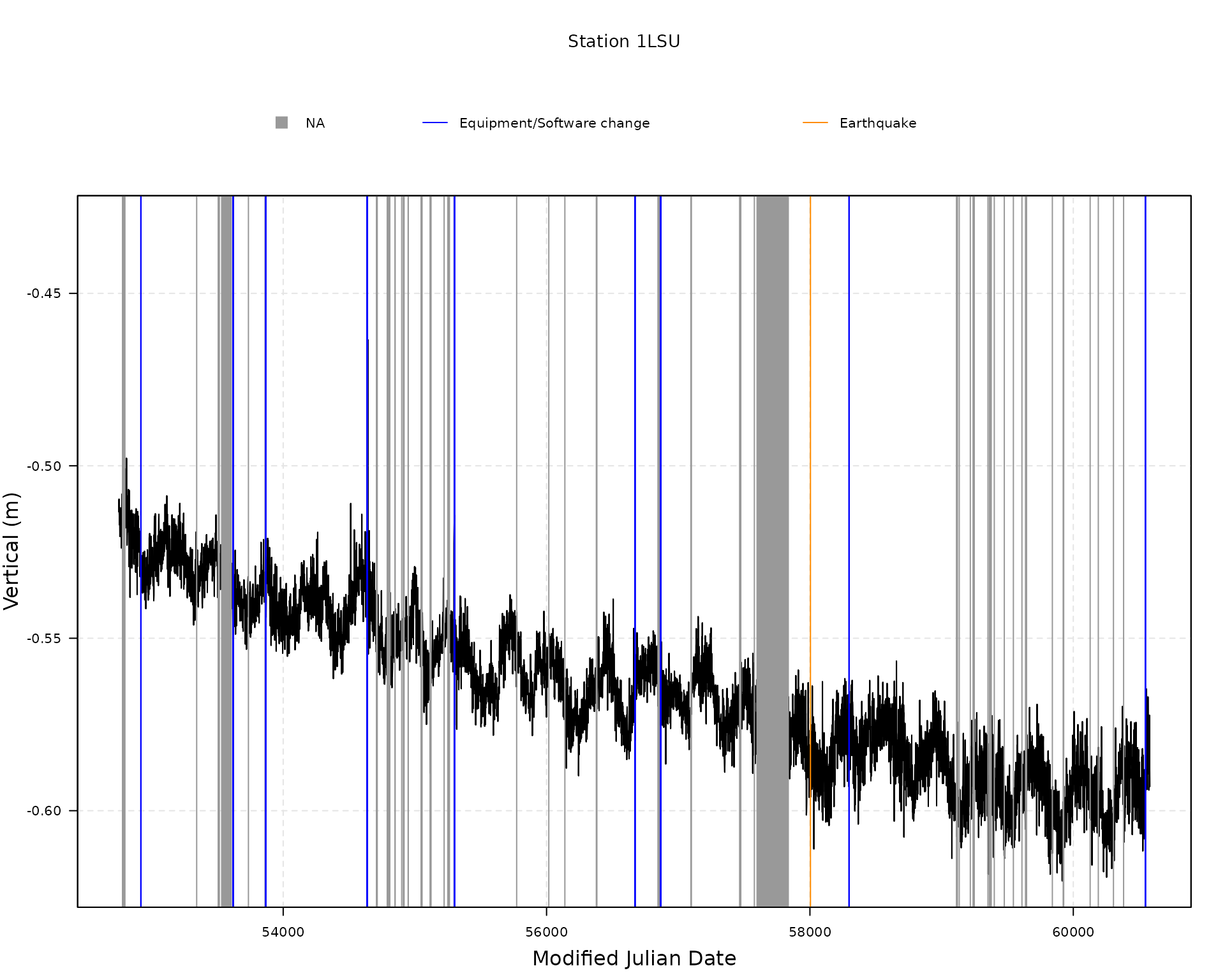
Load and plot data from Nevada Geodetic Laboratory
Source:vignettes/load_plot_data_ngl.Rmd
load_plot_data_ngl.RmdLet us first load the gmwmx2 package.
Download all available stations from NGL
all_stations <- download_all_stations_ngl()
head(all_stations)
## station_name latitude longitude height
## <char> <num> <num> <num>
## 1: 00NA -12.46664 -229.1560 104.85105
## 2: 01NA -12.47822 -229.0180 105.40857
## 3: 02NA -12.35592 -229.1183 117.65247
## 4: 0ABI 68.35434 -341.1836 431.38847
## 5: 0ABN 65.03368 -338.6671 52.76211
## 6: 0ABY 58.65891 -343.8204 60.54753Download one station
data_1LSU <- download_station_ngl("1LSU")Extract GNSS position time series of station
attributes(data_1LSU)## $names
## [1] "df_position" "df_equipment_software_changes"
## [3] "df_earthquakes"
##
## $class
## [1] "gnss_ts_ngl"
head(data_1LSU$df_position)## station_name date decimal_year modified_julian_day gps_week
## <char> <char> <num> <int> <int>
## 1: 1LSU 03APR23 2003.307 52752 1215
## 2: 1LSU 03APR24 2003.310 52753 1215
## 3: 1LSU 03APR25 2003.313 52754 1215
## 4: 1LSU 03APR26 2003.315 52755 1215
## 5: 1LSU 03APR27 2003.318 52756 1216
## 6: 1LSU 03APR28 2003.321 52757 1216
## day_of_gps_week longitude_reference_meridian eastings_integer_portion
## <int> <num> <int>
## 1: 3 -91.2 1896
## 2: 4 -91.2 1896
## 3: 5 -91.2 1896
## 4: 6 -91.2 1896
## 5: 0 -91.2 1896
## 6: 1 -91.2 1896
## eastings_fractional_portion northings_integer_portion
## <num> <int>
## 1: 0.710905 3365278
## 2: 0.711658 3365278
## 3: 0.710608 3365278
## 4: 0.710365 3365278
## 5: 0.710191 3365278
## 6: 0.709996 3365278
## northings_fractional_portion vertical_integer_portion
## <num> <int>
## 1: 0.822462 -6
## 2: 0.822461 -6
## 3: 0.821198 -6
## 4: 0.822708 -6
## 5: 0.823504 -6
## 6: 0.821861 -6
## vertical_fractional_portion antenna_height east_sigma north_sigma
## <num> <num> <num> <num>
## 1: -0.518135 0 0.000770 0.000826
## 2: -0.513158 0 0.000814 0.000838
## 3: -0.512472 0 0.000789 0.000829
## 4: -0.522002 0 0.000810 0.000851
## 5: -0.516939 0 0.000810 0.000851
## 6: -0.519796 0 0.000802 0.000858
## vertical_sigma east_north_correlation east_vertical_correlation
## <num> <num> <num>
## 1: 0.003138 -0.016190 0.051348
## 2: 0.003325 -0.045837 0.028720
## 3: 0.003217 -0.005310 -0.038035
## 4: 0.003332 -0.040613 -0.025021
## 5: 0.003306 -0.002084 0.023121
## 6: 0.003336 0.000188 0.024412
## north_vertical_correlation nominal_station_latitude
## <num> <num>
## 1: -0.079018 30.40742
## 2: -0.133744 30.40742
## 3: -0.065320 30.40742
## 4: -0.098485 30.40742
## 5: -0.054431 30.40742
## 6: -0.068907 30.40742
## nominal_station_longitude nominal_station_height
## <num> <num>
## 1: -91.18026 -6.51814
## 2: -91.18026 -6.51316
## 3: -91.18026 -6.51247
## 4: -91.18026 -6.52200
## 5: -91.18026 -6.51694
## 6: -91.18026 -6.51980Extract equipment or software changes steps
head(data_1LSU$df_equipment_software_changes)## station_name date_YYMMDD step_type_code type_equipment_change
## <char> <char> <int> <char>
## 1: 1LSU 03OCT08 1 Logfile_Changed
## 2: 1LSU 05SEP06 1 Elevation_Cutoff_Changed
## 3: 1LSU 06MAY11 1 Receiver_Make_and_Model_Changed
## 4: 1LSU 08JUN20 1 Antenna_and_Radome_Type_Changed
## 5: 1LSU 08JUN23 1 Elevation_Cutoff_Changed
## 6: 1LSU 10APR14 1 Antenna_Type_Changed
## modified_julian_date
## <num>
## 1: 52920
## 2: 53619
## 3: 53866
## 4: 54637
## 5: 54640
## 6: 55300Extract earthquakes steps
head(data_1LSU$df_earthquakes)## station_name date_YYMMDD step_type_code treshold_distance_km
## <char> <char> <int> <char>
## 1: 1LSU 17SEP08 2 2041.738
## distance_station_to_epicenter_km event_magnitude usgs_event_id
## <num> <num> <char>
## 1: 1733.135 8.2 us2000ahv0
## modified_julian_date
## <num>
## 1: 58004


